Field Trips
Field trips are scheduled on Tuesday 8th September and are complimentary.
Explore the trips below and select your preferred trip in your registration
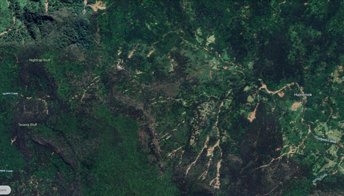
Tweed River and Tallebudgera Creek
This field trip explores river management challenges and rehabilitation sites along the mid Tweed River near Mount Warning (Wollumbin) and Tallebudgera Creek in the Gold Coast Hinterland—both high energy gravel-bed streams draining the dramatic landscapes of the Border and Tweed Ranges.
Located within one of the highest rainfall regions of northern NSW and southeast Queensland, these catchments experience powerful floods that shape channel form and drive ongoing management challenges – both systems were heavily impacted by the 2022 flood events. Participants will visit sites that highlight issues such as channel stability, sediment dynamics, flooding impacts, and riparian rehabilitation in high-energy systems. Along the way, the trip showcases the natural beauty of this region, travelling through subtropical rainforest landscapes and over the picturesque Border Ranges.
Extreme Floods and Erosion in the Richmond Catchment: Implications for Catchment Management
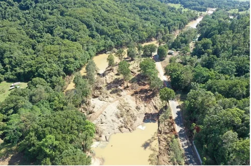
The February–March 2022 floods in the Richmond River catchment triggered an extreme geomorphic response that challenges current approaches to erosion management. More than 1000 mm of rainfall in 72 hours in the upper catchment initiated over 1,600 landslides, generating approximately 970,000 m³ of erosion and delivering an estimated 710,000 tonnes of sediment directly into the river network.
Landslides alone likely contributed 20–30% of the total sediment load during the event, yet they are not explicitly included in existing sediment budgets or water-quality models used to guide catchment management. The event also revealed the vulnerability of steep, forested headwaters—areas typically considered low risk in erosion prioritisation frameworks—and demonstrated how extreme rainfall can trigger nonlinear and episodic sediment responses that overwhelm conventional mitigation approaches.
This field trip examines key sites across the Richmond catchment, including the landslide-affected Upper Coopers Creek valley and lower Wilson River reaches, to explore post-flood channel adjustment, landscape recovery, and implications for future management. The sites highlight the need to better incorporate extreme events, landslide processes, and recovery trajectories into catchment planning and flood-resilience strategies.
Nature Based Solutions for Estuarine Recovery along Emigrant Creek and the Brunswick River
Overview: Mimicking natural estuarine recovery processes promotes low energy environments that provide for macrophyte recruitment and storage of diffuse pollutants.
Nature Based Solutions (NBS) have become an increasingly popular approach to stream restoration due to reduced site legacies and improved habitat function. Several challenges and knowledge gaps persist in estuarine environments which limit the success of NBS such as the need for a multidisciplinary approach and a general lack of detailed examples utilising natural recovery processes monitored under extreme hydrodynamic settings.
On this trip we will explore sites on Emigrant Creek and the Brunswick River that have been delivered to help address these key questions along with emerging issues in estuarine management within the region.

North Coast Local Land Services, Southern Cross University

North Coast Local Land Services, Byron Shire Council